Category Archives: landscape planning

Did they make a mistake with Copenhagen's Green Finger landscape plan?

Should Copenhagen's Five Fingers be green or grey?

Copenhagen’s Finger plan (left) is appealing: easy to remember and attractive for the way it gives prominence to greenspace in the planning of a capital city. But, for the way it has been used (centre) it should be called the Grey Finger Plan. The idea was to run out high-speed railway lines from central Copenhagen and use them as urbanisation spines, with the space between the fingers retained as greenspace. In a real Green Finger Plan the fingers themselves would be green, as on the right-hand diagram. Here are some suggestions for how it could have worked:

  1. build the railways with earth embankments as environmental noise barriers – probably with space for an express roadway in the same corridor
  2. use the fingers as green infrastructure corridors for the urbanisation – growing the fingers as the urbanisation spreads
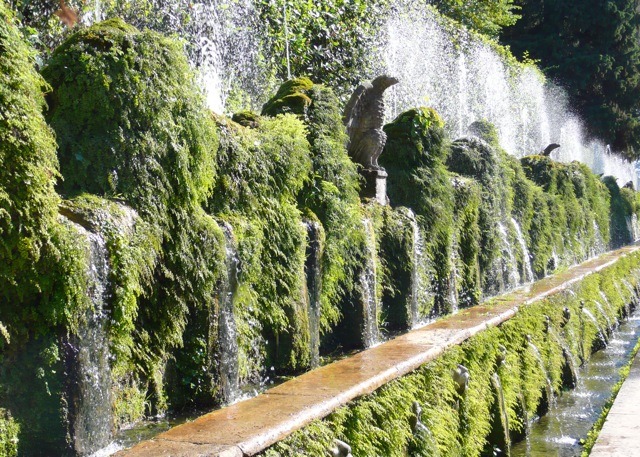
  3. also use the fingers as utility corridors for: cycleways, habitat space, recreation space, a city forest, urban water runoff management, urban agriculture etc
  4. extend ‘ribs’ of cycleway from rail stations into the urban areas between the green fingers
  5. consider building above the railways and roads at some future date, to accommodate shops, offices and other commercial uses

The Danish name is the København 5 Fingerplanen but is described as the Green Finger Plan in the European Landscape Convention and other places. ‘Storkøbenhavn’ means ‘Metropolitan Copenhagen’.

Singing the greens: Joni Mitchell in concert 1970 – Big Yellow Taxi

They paved paradise
And put up a parking lot
With a pink hotel, a boutique
And a swinging hot SPOT
Don’t it always seem to go
That you don’t know what you’ve got
‘Til it’s gone
They paved paradise
And put up a parking lot


They took all the trees
And put them in a tree museum
Then they charged the people
A dollar and a half just to see ’em
Don’t it always seem to go,
That you don’t know what you’ve got
‘Til it’s gone
They paved paradise
And put up a parking lot

Sugar may be the world's worst poison – so the EU subsidises sugar growers through its Common Agricultural Policy (CAP)

Sugar is a deadly poison and subsidised by the EU Common Agricultural Policy CAP. So grown your own food!

Prof John Yudkin showed, in 1957 that the consumption of sugar and refined sweeteners is closely associated with coronary heart disease and type 2 diabetes. The argument was presented in a famous book Pure, White and Deadly (1972) which was, of course, bitterly attacked by the sugar and soft drinks industries. This may be why Robert H. Lustig (Prof of Clinical Pediatrics, at the University of California) called his much-watched Youtube video Sugar:the Bitter Truth. He extends Yudkin’s argument and explains how sugar is a major factor in heart disease, hypertension and many common cancers, with most of our sugar intake coming from processed foods and soft drinks. A dangerous consequence of eating sugar is that it stimulates the apetite and makes you put on weight. The food processors’ second favourite additive, salt, may be the world’s second worst poison.
So how does the EU’s Common Agricultural Policy (CAP) deal with this terrible poison? It gives its largest subsidies to sugar producers, of course. Tate & Lyle Europe is the largest UK recipient of CAP money (T&L has received €828m since 1999). I say ‘of course’ because the CAP is a very bad thing, if not quite as bad as the Common Fisheries Policy (CAF) which has led to the ruination of Europe’s fish stocks.
So what has sugar to do with landscape and gardens? Two things (1) the safest food to eat is food which has not been influenced in any way by food processing or the CAP (ie food which has been home grown in gardens and urban agriculture plots) (2) Europe’s current financial crisis is the best hope for some time that the CAP might be reformed – and when this happens there will be an opportunity to switch some of the expenditure towards rural public goods – and away from such notable public bads as the production and use of sugar in processed foods. Landscape planning for growing vegetables in urban areas has to become a key input to the urban design process. It involves strategic policies for water, soils, air, light recycling, land-use and roofspace-use.
The safest nutritional policies are (1) grow you own food (2) cook your own food. The home-grown tomatoes in the above photograph are so delicious they do not need cooking or flavouring. An interesting thought is that if more people composted household waste and grew their own food then GDP/head would fall, because less food would be sold, transported etc. There would also be less expenditure on health care. So I guess politicans, who are elected for promoting ‘economic growth’ will be against it, supported by their economic advisers.

Olympic 2012 Park landscape and architecture

In 2005 I made my predictions and stated an intent to monitor the progress of the 2012 London Olympic Park. I took 500+ photographs of the site and hoped to follow the changes. This did not work, because they had to close off public access to the site, but I was kindly invited to view progress on 22.7.2011. The first point to strike me, on the jaw, was the total inability of the architects to work together. There is no relationship of any kind between the sports buildings. What, one might ask, can one expect of Zaha Hadid (Aquatics Centre), Michael Hopkins (Velopark), Populous (Olympic Stadium) or MAKE (Handball Arena)? This is an easy question to answer: I expected them to TALK to each other and to create a whole which is more than the sum of its parts, more than a bag of Liquorice Allsorts. I also expected the client to ensure that this conversation took place and had a fruitful outcome. But they didn’t. The landscape architects could have done the design co-ordination, had they been asked. Instead, they have designed a swathe of greenspace which can be expected to help in unifying the outdoor landscape. The underlying principles are ‘Bauhaus’: the outdoor form of the buildings reflects their internal function. The buildings have an outdoor setting which is more nature than garden (like the Meisterhäuser in Dessau). Someone, as yet unidentified, had the excellent idea of having acres and acres of wildflower meadow flowing around the buildings and along the river. It will be colourspace instead of greenspace and it will help distinguish the 2012 Olympic park from a 1980s British Garden Festival.
A very disappointing aspect of the Olympic 2012 Park is that the general public will have NO ACCESS in 2012. We Londoners have paid for many of the facilities. We will have our city greatly disrupted during the games. But there are no plans to let us see our park. Only the ticket holders will have this privilege – and a great many more people applied for tickets than have received tickets. A friend bid for £3000 of tickets and got none. After the Olympic Games end the plan is to keep the park closed and set about the task of transforming it for public access some time in 2013. I urge a re-consideration. They should open the park to FREE PUBLIC ACCESS FOR AT LEAST TEN DAYS AFTER THE END OF THE GAMES.
My 2005 comment on the prospects for the 2012 Olympic Park gave reasons for optimism and reasons for pessimism. In July 2011 the site looked like a road widening scheme near an airport, so I can’t say. My guesses are (1) the wildflowers will be wonderful (2) the buildings, as individual objects, will be handsome (3) there is a risk of the end product resembling a collision between an airport and garden festival. Let’s hope I’m wrong.
The below photograph, also taken from outsidethe park, shows what might have been achieved inside the park if more of the vernacular Lea Valley could have been retained. My belief is that it could have been done and that it has not been done.

Contemplative places: watching and listening

Contemplation has been defined as thoughtful or long consideration or observation. In the East, Christian contemplation has been associated with spiritual transformation. “The process of changing from the old man of sin into the new born child of God and into our true nature as good and divine is called theosis.” The process has often been described by the metaphor of a ladder, with the acquisition of the state of hesychia or peace of the soul being the summit where the person is said to reach ‘Heaven on Earth’.

Perhaps the purpose of a public contemplative space might be to give visitor glimpses of ‘Heaven on Earth’? What might such a space look and sound like?

Natural spaces are most often associated with a sense of restfulness and peace. Water can create a sense of calm, while beauty can promote a sense of wonder.

High buildings, skyline policy and the creation of a new urban landscapes

Can skyline and roofscape design policies help in the creation of new urban landscapes


I have often noticed, from photographs, that Sydney’s urban landscape looks all the better for the way in which high buildings are clustered in the central business district. If you took the tall buildings in the above photograph and distributed them evenly across the urban landscape, which is rather what London has done with its tall buildings, then you would get an effect like a suburban cemetery but on a larger scale. Or you could compare it to the mouth of a poor old tired horse with large gaps between the rotting teeth.
I think cities should group tall buildings with a view to creating scenic effects and beautifully dramatic skylines. One way of doing this is by drawing roofscape contour plans, in a similar manner to landform contour plans. One could say that it costs no more to group the buildings beautifully than to group them haphazardly, but the grouping would impact on the wishes and desires of individual landowners. So is the idea totally unbusinesslike and unrealistic? Or is it something that cities will need to do in a world when they are competing with each other to become destinations for businesses and tourists and residents?
Patrick Abercrombie drew some interesting diagrams so show the urban morphological choices which, in theory, face urban designers. Underneath his diagrams you can see my idea of what urban roofscape contours might look like – and would look like if someone applied the idea of roofscape mapping to Sydney’s central business district.

Above image courtesy Ingo Meironke Below image courtesy thewamphyri