Monthly Archives: March 2011

Can landscape architects make a contribution to the safety of nuclear reactors, like Fukushima?

Large scale planted and reinforced earth mounds would provide use protection against Tsunamis

With much sympathy for the plight of North Japan, I make the suggestion that the Fukushima Nuclear Reactors might have been much better able to resist the force of the Tsunami if there had been a 50m+ planted grass mound between the four reactors and the sea: (1) it would have cost very little money in proportion to the good it might have done (2) it would have made the Fukushima site more beautiful, because most industrial clutter is at ground level (3) it would have had ecological benefits (4) the earth might have been of use in an emergency.
So if any of our readers manage coastal nuclear reactors and would like help with the design of a protective bund, please use our contact form and I will find a former University of Greenwich landscape architecture MA student to do the job for you: there are few countries without them. If the above suggestion is impractical, they will be able to help you with energy saving through sustainable landscape architecture and planning – so that your country will have less need for nuclear power.
Image courtesy Beacon Radio

From the ground up, the sky is the limit…

Turned upside down land-scape becomes sky-scape. So what happens when the city meets the sky? 56 Leonard Street by Swiss architects Herzog & de Meuron disrupts the orderly rhythm of both the street-scape and of the skyline of New York with its jagged form from base to crown.

The base of 56 Leonard Street is firmly part of the city, while the crown of the building challenges the city limits: the blue space. Another blue space on the edge of cities is the coastal edge. The NSW government have included guidelines for protecting coastal edges near settlements.

At the limits of the green space of southern Californian cities according to biologist Paul Beier is cougar territory. While in Lincoln County efforts have been made to have developers include tree plans in their development applications (with fines for non-compliance).

In Germany there has been a conversation since the end of last millennium about ‘quality growth’ and ‘optimal growth’ at the edge of cities. In this paradigm according to Bruns and Schmidt in their paper ‘City Edges in Germany: Quality Growth and Urban Design’ “Land is valued for its own right, as landscape, as having character, contours, and limits. ‘Green walls’ instead of built walls are to be designed to border the city.”

How should a city meet its landscape in the twenty-first century?

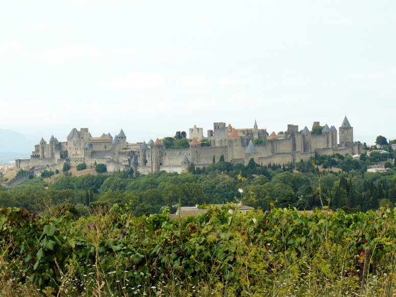
The separation between City and Landscape was very clear in the Middle Ages: the city stopped and the landscape began, as in Carcasonne. This was the relationship in Europe, India, China and elsewhere. Twentieth century cities learned to sprawl. The city centres were dense enough, but the suburbs often had too much wasted land and the surrounding countryside was littered with so many lumpy buildings that it came to be called Nowhere Land.
So what should we do in the twenty-first century? Some of the problems are (1) putting limits on city size has proved impossible (2) poor people always want to move to cities from the countryside (3) rich people, in Europe and America want to move from city centres into the countryside.
My answer to the question at the head of this post is: define greenspace as ‘landscape infrastructure’ in advance of city expansion. McHarg-type landscape assessments should be made of the land around cities and long-term designations should be made to create an extensive web of land on which no building will ever be allowed. My guess is that the web will be based on (1) the existing pattern of rivers, streams and ditches (2) skyline ridges. Urban edges should be defined on the margins of this future greenweb and these margins will become the future equivalent of medieval city walls.
The IFLA student competition on Urban Boundaries is a welcome contribution to the debate.

Photograph of Carcasonne, courtesy John Wesley Barker.

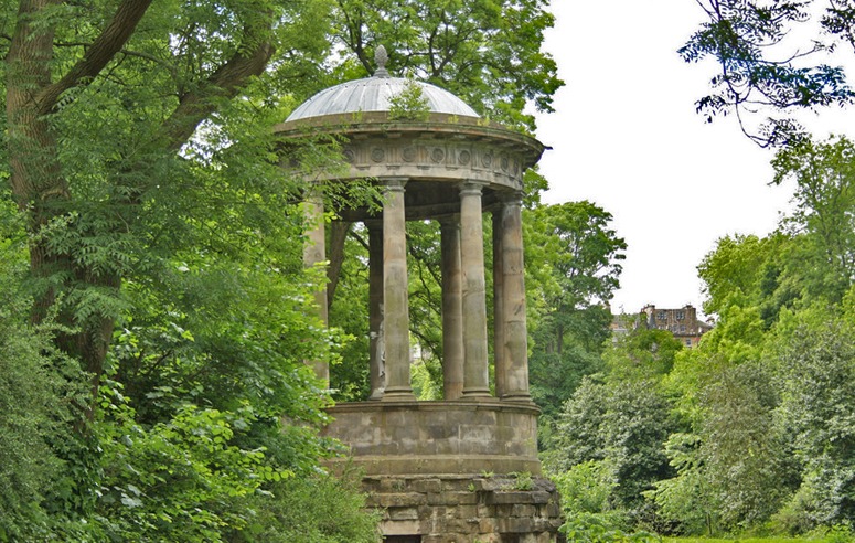
The Earl of Moray's Pleasure Ground, in Edinburgh is an excellent example of a greenway with an urban edge (just visible on the skyline)

Image of St Bernards Well in Edinburgh courtesy Jonny Ho

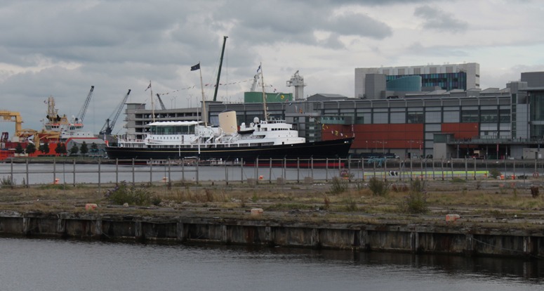
The Royal Yacht Britannia deserves a fine landscape setting – not a trashy mooring

Britain’s last Royal Yacht, the Britannia, is now ‘permanently moored as a five-star visitor attraction in the historic Port of Leith, Edinburgh’ and the setting is a total disgrace. The ghastly building which dwarfs the yacht is Ocean Terminal ‘an urban shopping centre & entertainment complex designed by Conran & Partners in London and handed over to Keppie Design’. Though I am pleased Scotland has regained a parliament, I am very disappointed by its lack of design and planning vision. The nearest they have to a design policy is ‘Hey Jock, what the hell, let’s get it built asap’. That ugly slab of a building is as ugly inside as it is outside and one can imagine that the planning officers were promised a lifetime’s supply of haggis in return for mooring the poor yacht here. I would like to see a competition for finding a better landscape setting for the old lady. Where can one find the best examples of historic ships moored in beautiful and romantic settings?

Rule Britannia!
Britannia rule the waves.
Britons never, never, never shall be slaves.
The nations, not so blest as thee, (eg Scotland)
Must in their turn, to tyrants fall,
Must in ,must in, must in their turn, to tyrants fall,
While thou shalt flourish, shalt flourish great and free,
The dread and envy of them all.
Rule Britannia!
Britannia rule the waves.
Britons never, never, never shall be slaves.

Living green bridges are vernacular landscape biotecture

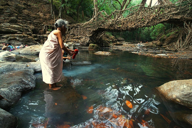
Living bridges? I found a nineteenth century drawing of living green bridge in 2009 and was delighted to find that they still exist. We can see it as vernacular landscape biotecture (using the word biotecture as a contraction of biological archiecture). The above example of a living root bridge is near Mawlynnong in the Khasi hills, in the Indian State of Meghalaya. Before you rush out any bridge construction detail based on this photograph please remember that ‘Meghalaya’y means The Abode of Clouds. Assam is to the north and Bangladesh on the south. A village near Cherrapunji in the Khasi Hills is the wettest place on earth with an annual rainfall of just under 12000mm (ie 24 times London’s average annual rainfall of 500mm). One could attempt a living bridge with willows in England, but I think it would turn into a dam, because the branches would root into the water.
Image courtesy Seema KK.