- England
- Scotland
- France
- Holland
- Germany
- Italy
- Spain
- Portugal
- USA
- China
- Japan
- India
- Iran
- Advice
- Gardens
- England
- Scotland
- France
- Holland
- Germany
- Italy
- Spain
- Portugal
- USA
- China
- Japan
- India
- Iran
- Advice
- Garden Tours
Book: Landscape Planning and Environmental Impact Design: from EIA to EID
Chapter: Chapter 4 Public open space POS
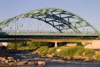
'Greenway' has come to be used as a generic term for all the kinds of connected 'green' space discussed above. The first use of the term is thought to have been in the name of the Santa Clara Greenway. In 1968, W.H.Whyte described it as 'an 8-mile network of trails, with "nodules" of open space provided by eighteen school sites' (Whyte 1970: 202). The Platte River Greenway in Denver was named in 1974 (Searns 1995). It includes parks, kayak chutes, and a waterfront plaza, linked together with a 160-mile network for walkers and cyclists. Whyte also praised the work of Philip Lewis in planning 'quality corridors' for Winconsin. Lewis said that: The flat, rolling farmlands and expansive forests have their share of beauty. But it is the stream valleys, the bluffs, ridges, roaring and quiet waters, mellow wetlands, and sandy soils that combine in elongated designs, tying the land together in regional and statewide corridors of outstanding landscape qualities (Whyte 1970: 218). Whyte's own advocacy of 'linkage' undoubtedly influenced the greenway movement. In the final chapter of his brilliant book, The Last Landscape, Whyte wrote: The best way to enhance the structure of the future metropolis is to save open space now for what it will do now. Later there may be new and unforseen uses for the land... The use does not have to be recreation, though this is of the first importance. In a few cases intensity of use will be low, as with a nature sanctuary. But in almost all cases there should be maximum visual use. Linkage is the key (Whyte 1970: 398). Since this was written, many people have advocated greenways as linear zones with a special focus on environmental objectives (Smith & Hellmund, 1993). These can include biodiversity, habitat protection, historic preservation, erosion control, flood hazard reduction, water quality improvement, air quality improvement, education and interpretation, scenic protection and recreational provision. The theory of island biogeography (MacArthur and Wilson, 1967) supports the creation of environmental greenways with its claim that the fragmentation of ecosystems into 'islands' is a threat to biodiversity (Harris 1984). Since human action is a prime cause of fragmentation, it follows that biological greenways are most necessary in areas of intensive human use (Noss 1993). In order to counter habitat fragmentation, connectivity should be increased and porosity decreased (Formon and Godron 1986). Greenways can also be places in which cultural diversity is protected and enhanced. The Minute Man national Historic Park in Massachusetts is being managed to recreate a historic landscape at the time of the revolutionary battle of 19 April 1775 (Ahern 1995). Over 175 homes and businesses have been removed from what was becoming a suburban area. Woodlands, farmlands and wetlands are being managed to resemble their condition in 1775. The Cumberland Valley is one of the few lowland sections of the Appalachian Trail . A 26 km corridor of land varying in width from 60m to 520m was acquired between 1979 and 1992. It is now being managed both as an ecological and a cultural resource. Old farms are being restored and their buildings given new uses: 'For local residents, the historic agrarian landscape within the trail corridor should provide a glimpse into the Cumberland Valley 's past.' (Yahner et al 1995). Greenways can be managed, in and around urban areas, in a similar manner to Britain 's National Parks, using the following measures: Aquisition of development rights. In Britain , land development rights were effectively nationalised in 1947. In America , development rights can be purchased by public authorities or they can be pooled by groups of private landowners. Designation of greenway boundary. This should be done on the basis of a wide-ranging landscape inventory and assessment. Landscape development. Public funds should be used to acquire access easements and to carry out landscape conservation and improvement projects, such as habitat restoration, river channel improvement, footpath and cyclepath construction. These measures are much less expensive than wholesale land aquisition and produce more diverse results because the energies of land owners are employed. But they need to be supplemented, in places, by the purchase of land. Local communities are suitable owners and individual landscape planners can take the initiative, if they have vision (Fink & Schwarz, 1993).
