- England
- Scotland
- France
- Holland
- Germany
- Italy
- Spain
- Portugal
- USA
- China
- Japan
- India
- Iran
- Advice
- Gardens
- England
- Scotland
- France
- Holland
- Germany
- Italy
- Spain
- Portugal
- USA
- China
- Japan
- India
- Iran
- Advice
- Garden Tours
Book: Landscape Planning and Environmental Impact Design: from EIA to EID
Chapter: Chapter 2 Landscape plans for public goods
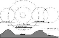
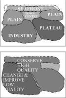
One may think that mapping scenic resources is more difficult than mapping other natural resources. As children of the romantic movement, many of us believe that "beauty is in the eye of the beholder". This appears to make scenic mapping impossible. But a surprising fact about scenic quality makes the task feasible. Almost every researcher has discovered a high degree of consensus about scenic quality in the natural and in the built environment. If you ask random groups of Burmese farmers, Japanese businessmen, Chinese fishermen, Dutch tourists and African nomads about their tastes in art, food, music and books, you will discover few correlations. But if you ask them about scenic quality, you will find a quite astonishing degree of consensus. People love views of mountains, lakes, rivers, houses set amongst trees, dramatic urban skylines and towns with good public spaces. This makes Scenic Quality Assessment (SQA) feasible. As individuals, we are constantly engaged in assessing the quality of what we see, as when buying food and clothes, arranging a house, or planning a holiday. Public bodies, disliking criticism and fearing ridicule, have taken to SQA with some reluctance, but in the developed countries they have done so for the following reasons: 1) To define areas of high scenic quality (eg National Parks or Urban Conservation Areas), for protection or for tourist development. 2) To define areas of low scenic quality which merit reclamation programmes (eg areas which have been despoiled by industry). 3) To analyse the scenic context for a major development project (eg a power station), so that the project design can be contextualised. 4) To define scenic areas in which special management policies will apply (eg grants for repairing stone walls). Assessment of scenic quality is sometimes described as "landscape evaluation" or "visual evaluation". These terms are misleading. Most people think of "landscape" as a geographical term, so that an "evaluation" would have to include functional and biological, in addition to aesthetic, characteristics. The term "visual evaluation" has two drawbacks. First, it implies a smaller scale of concern than "scenic". Second, it refers more to perception than appraisal. In the UK there are guidelines for "landscape assessment" (Countryside Commission 1987), meaning scenic assessment, and for "landscape and visual impact assessment" which includes other types of landscape imapct (Landscape Institute & Institute of Environmental Asssessment, 1995). The two stages in effecting a Scenic Quality Assessment (SQA) can be clarified by thinking of the landscape as an estate. The owner has died and land agents have been appointed to assess the value of the property. Their tasks are inventory and valuation. Scenic assessors have the same tasks, which are likely to be followed by policy formulation. The tasks should be done partly at one's desk, using maps and aerial photographs, partly in local art galleries, partly in the library, and partly in the field, using a notebook, a sketchbook, a camera, sandwiches, a bicycle and walking gear. An overhead flight is of great assistance in taking a comprehensive view. The inventory will map and catalogue the components of the landscape. On a private estate, the items in the sale catalogue are likely to be functional: farmland, woodland, fishing grounds, gardens, a house, out-buildings etc. When cataloguing the wider landscape, the units will be more topographical: hills, valleys, streams, farmsteads, sea cliffs and so forth. When urban areas are included, the list may extend to housing, industry, parks, retailing and transport. Landscape units are useful for defining policy areas, though different aspects of the landscape will result in alternative sets of units [Fig 2.23] Landscape units are bound to overlap Maps showing non-overlapping units, for landscape quality or landscape character, are founded on an intellectual error [Fig 2.24]. Units may be defined: As policy areas. Coastal management, for example, will require a map showing Zone of Coastal Influence, which will overlap with units defined for other purposes. As viewshed areas. These may be defined by ridge lines, woodlands, buildings etc. The area within a viewshed can be computed with a GIS programme and mapped as a Zone of Visual Influence (ZVI). As natural areas. These will result from natural processes (geology, soils, hydrology, elevation, aspect etc) As man-influenced areas. These will be both modern (eg arable land, grazing land, forestry, housing, industry) and historic (eg ancient settlements, farms, commons, roads, battlefields and areas associated with writers and artists). Scenic evaluation should be carried out when units have been defined. As with the task of definition, there should be desk studies and field studies. After spending many years planning weekend visits to areas of town and country, I learned that a surprisingly accurate estimate of scenic quality can be made from maps. If there is a steep mountain beside a lake with a fringe of trees along a sandy shore, the natural scenic quality is likely to be high. If there is dense urban development around a castle, the historic scenic quality is likely to be high. If there is a large area of suburban housing with a repetitive geometrical pattern, the place is likely to be dull. If there is a uniform road pattern through an industrial area, it is likely to be ugly. These observations lead to the conclusion that although beauty may be subjective ("in the eye of the beholder"), it is possible to base good predictions of scenic quality upon objective criteria: slope, elevation, vegetation, water, geology, age of buildings and other artifacts. These elements can be included in a landscape inventory. If objective landscape elements are regarded as predictors of scenic quality, rather than determinants, the ancient philosophical debate as to whether aesthetic value is subjective or objective can be left on the sidelines. Like the rules of a game, this debate sets parameters without determining the outcome. From the time of Plato and Aristotle (c400 BC) until the start of the eighteenth century, most western philosophers believed aesthetic quality to be objective. It was judged with reference to principles, like the Golden Section and the Rules of Taste. Further evidence for the objectivity of beauty came from the fact that certain works of art had been appreciated since Ancient Times. After c 1700, the rise of empiricism and the Romantic Movement led to the predominant modern view that aesthetic quality is a subjective matter. Taste in scenery has changed with tastes in art. We now love deep forests, mountains and rocky coasts, which used to be viewed with horror. It seems highly probable that our descendants will share our taste for wildness, but we cannot know.