- England
- Scotland
- France
- Holland
- Germany
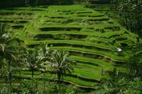
- Italy
- Spain
- Portugal
- USA
- China
- Japan
- India
- Iran
- Advice
- Gardens
- England
- Scotland
- France
- Holland
- Germany
- Italy
- Spain
- Portugal
- USA
- China
- Japan
- India
- Iran
- Advice
- Garden Tours
Book: Landscape Planning and Environmental Impact Design: from EIA to EID
Chapter: Chapter 7 Agriculture, farming and countryside policy
Farmland is the result of untold centuries of work. History used to be conceived as tales of the kings, armies and churches. It was studied from documentary records and from old buildings. Increasingly, it is recognised that everything has a history. New methods of investigation are being developed and historians are diversifying their effort. As a source material for this wide sphere of investigation, the countryside has no rival. It is a vast repository of information about use of the Earth's surface by man and other animals. But the repository is being destroyed. Oliver Rackham writes that: 'The landscape is like a historic library of 50,000 books. Many are were written in remote antiquity... every year 50 volumes are unavoidably eaten by bookworms... a thousand are sold for the value of the parchment...'. (Rackham, 1990:29). Abercrombie, in a lecture on Country planning and landscape design, said that 'the country is... the richest, the most vivid piece of history that we possess' (Abercrombie, 1934). The deliberate destruction of books by a society is a symptom of great evil to come. Ignorant destruction is a lesser evil, but still serious. The first step towards protection, as in a library, is to make a catalogue. Historic landscapes must be surveyed. Most countries have catalogued their 'ancient monuments'. The survey process must be extended to hedgerows and walls, cottages and fields, roads and tracks, bridges, woods and forests, banks and dykes, meadows, pastures, pits and ponds. New techniques are available, including air photography, remote sensing and pollen analysis. An army of unpaid amateur surveyors is coming forward to help with the work. Farmers know a great deal about their own land. Much information on 'industrial archaeology' has already been collected. There is a need for general surveys, as part of a full mapping exercise, and for detailed surveys, which are carried out as part of special projects. It will not be possible or desirable to preserve every historical feature, but it is very desirable to have records of any features which are disappearing [Fig 7.7] [Fig 7.8].